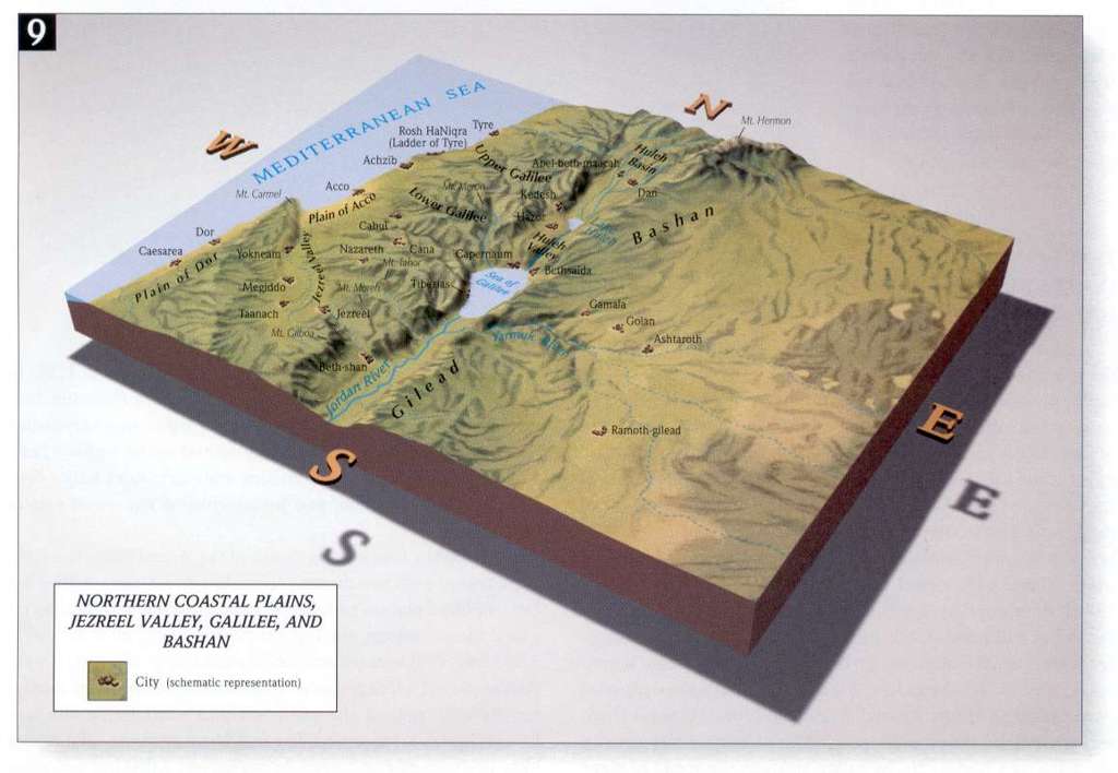
This site offers scanned pages of a complete Bible Atlas with colour maps. The headings in the table of contents will give you an idea of the scope of this online resource:
PART I: THE BIBLICAL SETTING 
Chapter 1 The Face of the Ancient Near East 
The Ancient Near East 001 
Biblical Regions 001a 
Modern States and the Ancient Near East 002 
Mesopotamia: Homeland of Abraham 003 
Egypt: Land of Bondage 004 
Syria and Lebanon 005 
International Routes, The King's Highway 006 
Geography and Trade Routes of the Middle East 006a 
Chapter 2 Natural Regions of Palestine 
National Regions of Ancient Palestine 007 
Physical Geography of Palestine 007a 
Topography of Palestine 007b* 
Cross Sectional Views of Longitudinal Zones 008 
Northern Coastal Plains 009 
Plain of Dor, Plain of Sharon, Samaria, et al. 010 
Philistine Plain, Shephelah, Judah, and the Dead Sea 011 
Arabah, Negeb, Wildernesses of Zin and Paran 012 
The Old City of Jerusalem Today 012a 
Modern Political Divisions of Ancient Palestine 013 
Climate Patterns of Ancient Palestine 014 
.
.
.
etc (there are 173 high quality maps available in this site - see below for examples)
 Topographical Map of Northern Costal Plain, the Jezreel Valley, Galillee and Bashan
Topographical Map of Northern Costal Plain, the Jezreel Valley, Galillee and Bashan Expansion of Christianity in the 2nd to 3rd Century AD
Expansion of Christianity in the 2nd to 3rd Century ADURL: 
http://www.studylight.org/se/maps/browse.cgi?st=1&pn=1